Pages

Eight excellent (and free!) resources for anyone interested in landscape architecture

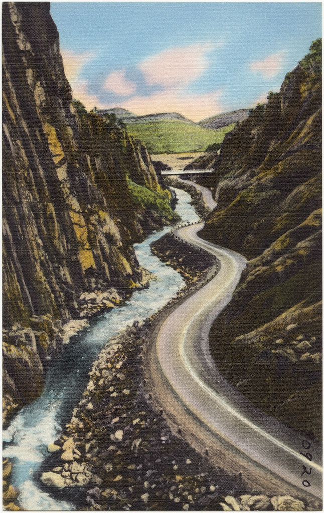
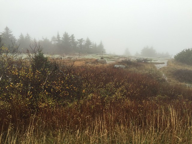
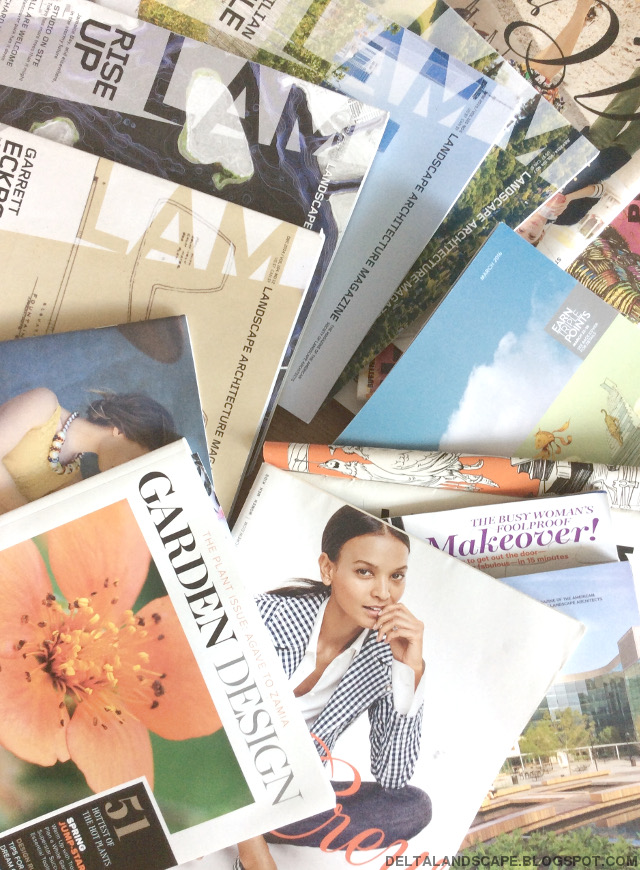
Magazines swaps are just one of many great resources for free information about landscape architecture and garden design.

When I first realized I was interested in landscape architecture, I wasn't sure where to start. For anyone interested in this subject, I've rounded up some of my favorite resources below to make the list I was hoping to find at the start of my journey. I hope it's helpful to someone out there!

1. Landscape Architecture Magazine (LAM) by ASLA

LAM tops the list as the most recommended reading material to me by practicing landscape architects. ASLA releases the magazine each month on the web and in print. You used to be able to read the magazine for free online, but now it looks like both the online and hard copy have a subscription rate. They do seem to be making one back issue available for free on their website. If you become a member of ASLA, a magazine subscription is included in your membership at no extra cost, but you don't have to be a member to purchase a magazine subscription. LAM and the ASLA website are also great places to find relevant books, and they run a blog called The Dirt.

2. The Cultural Landscape Foundation (TCLF)'s Pioneers Oral Histories

The TCLF is a great organization that I discovered through their Pioneers Oral Histories project. Each video about a legendary American landscape architect is a joy to watch, highly inspirational, and a wealth of information. Highly recommended.

3. The Library of American Landscape History's (LALH)

The LALH is another great resource for books and also has a magazine called View with some of the back issues available online for free. They also have a few films online accessible for free that are just as beautifully done as the TCLF's and absolutely worth watching.

4. "Frederick Law Olmsted: Designing America" film by PBS

Perhaps the first thing I ever learned about landscape architecture was who Frederick Law Olmsted was (through the well-written biography Genius of Place by Justin Martin). The TCLF and LALH both have stunning videos about Olmsted, but this PBS documentary approaches the subject in a slightly different way. The PBS website for the film also has further information about him.


My problem has evolved from not knowing what to read to not knowing what to read first.

5. Google Books

I recently discovered there are a lot of older books about landscape architecture that Google has scanned and made available online (and downloadable). The one I'm currently reading is An Introduction to the Study of Landscape Design by Henry Vincent Hubbard and Theodora Kimball Hubbard (1917), but this seems to be just the tip of the iceberg of Google's book stash. I have found older technical texts to be of high quality so I wouldn't discount them based on age alone. Styles may change (which is actually interesting from a historical perspective), but I expect the design principles underlying them to remain relevant.

6. Other magazines

Garden Design

Garden Design is a delight for the senses. Their photos are large and richly colored and their sometimes heavier weight pages feel like an investment to be treasured. The magazine is only published quarterly, which only serves to heighten anticipation. Their website seems like a good introduction but inadequate replacement for the printed periodical, but there are a few excellent articles there. My absolute favorite is "Landscape Design Rules" by Rob Steiner. That one article taught me more about landscape design than any other source so far. I also like their page on garden styles.

Vogue

Style extends beyond the sartorial to gardens at Vogue, as more often than not each issue includes a garden-related article. Their website also has some garden-related content. One of my favorite finds on their website is  "Miranda's Garden", a short film series that takes you behind the scenes of landscape architect Miranda Brook's work.

Architectural Digest

AD also seems to generally include a garden-related article in each issue. For example, this one. I especially like the older back issues of AD for their lengthy and in-depth pieces.

The New Yorker

To be honest, I sometimes don't even get the cartoons in the New Yorker, but a quick search for "landscape" on their website yields nearly 7500 results and among these are some gems that even I can comprehend. I recently enjoyed the videos of Joyce Carol Oates' garden and Bruce Davidson's search for nature in Los Angeles landscapes, and the articles about turning the lens on industrial landscapes and the Governor's Island project in New York.

These are just some of the widely circulated magazines that will run an article from time to time that may be of interest, and they are likely accessible for free through your local library.

7. Blogs -->

There are some seriously great bloggers out there. My "Following" list is a bit eclectic, and I'm sure it's incomplete, but there are several in there related to gardening and landscape architecture (some already mentioned above). Land8 is a community of landscape architects I recently discovered, and has a blog and a resource page worth checking out.

8. Local and regional resources

Wherever you live, there are probably local or regional organizations doing interesting things that you can either become a part of or read about somewhere. One that I really like is the California Garden & Landscape History Society for the "Resources" tab on their website, which is something anyone can benefit from regardless of how near or far away California is.


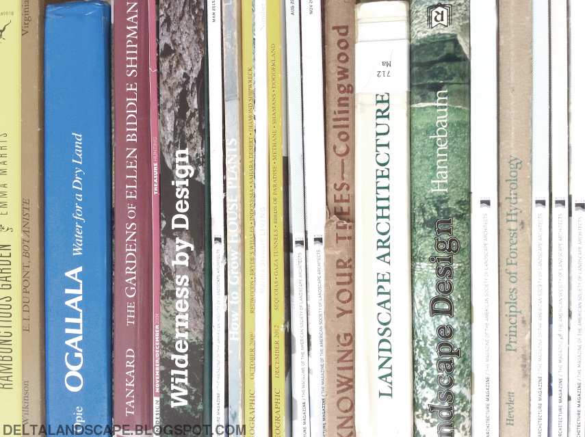
A quick round-up of some of the literature either read or in the reading queue around the house.

Basically what I try to do is keep an eye out wherever I go, online or off. From National Geographic to Harper's Baazar, you never know what lies between the covers unless you look. Library and other book sales have been a treasure trove of relevant literature at bargain prices. Book and magazine swaps have also proven useful. I find a lot of free back issues of Architectural Digest and even LAM through magazine swaps, and have also left many behind for the taking.

I didn't really get into books with this list. There are sooo many great books out there that in the future I hope to do more posts specifically about books. While some landscape architecture books may be available at your local library for free, many may not. I've already come across several great books on the subject not in my local library's collection. I have found several books for under $5 shipped online, so it's definitely worth keeping an eye out.

Did I leave out something great? What are you reading right now? What are your favorite books, magazines, websites related to landscape?

NPS 100th: a dozen national park scenes


In a quick post this week, I wanted to share some of the awe-inspiring images I've run across while reading about our national parks.

These are just a few of so many great photos out there. I hope you enjoy them as much as I did!


Thank you for letting me share! Are you visiting any NPS sites in honor of tomorrow's centennial?


Sources: 1 (kezee) / 2 (LOC) / 3 (Wilfred Hdez) / 4 (Thomas Moran) / 5 (Nick Mealey) / 6 / 7 (Melvin Vaniman) / 8 (Detroit Photographic Co) / 9 (Ansel Adams) / 10 (Daniel) / 11 (Chiura Obata) / 12 (John Muir portrait via LOC). 

NPS 100th: a David vs Goliath war for freedom I'd not heard of

Photo credit: Bob Wick (Bureau of Land Management via Flickr).

We're still about ten days away from the official NPS centennial, and I'm continuing to learn more about our national parks. There are so many interesting places, just as much history, and not enough time.

In reading about NPS history, one of many events that stood out to me was a David and Goliath story about the Nez Perce (also known as the Niimiipoo, more on names later). In the next few paragraphs, I've written down everything I've learned about the Nez Perce National Historic Trail, which is just enough to know that I have barely scratched the surface of this subject and probably only got the general gist of things right. Near the end of the post, I've listed several resources with further information for anyone interested. Here goes.


The Nez Perce National Historic Trail was established in 1986 to mark the 1170 mile pursuit of over 750 Nez Perce by the US Army in 1877. Image credit: NPS / Yellowstone Spatial Analysis Center.

Last week, on August 9, a century and thirty nine years ago, soldiers snuck up on unsuspecting and unarmed Niimiipuu (pronounced nee-mee-poo) - two thirds of which were women and children - in the early hours of the morning and killed them. Ninety Niimiipuu and about 30 army soldiers and volunteers were killed in what became known as the Battle of Big Hole.

The third of about 20 confrontations between the Niimiipuu and US Army, Big Hole appears to have been a significant turning point. The earlier battles had been clear victories for the Niimiipuu, and Chief Looking Glass had assumed the worst was over when his people set up camp at a familiar spot in Big Hole Valley to rest on August 7. Unfortunately, the soldiers spotted the camp the next day.


The Big Hole National Battlefield in Montana is part of the NPS, but the Historic Trail is managed by the Forest Service. Photo credit: Sue Ruth.

Despite the element of surprise, the Niimiipuu were quick to organize an effective defense. They cornered the soldiers under lodgepole pines for 24 hours, enabling their people to escape.

Big Hole was technically another victory for the Niimiipuu, but the battle seems to have created an irreconcilable rift. Up until Big Hole, the Niimiipuu endeavored to pass peacefully through the settlements along their route, but the battle seems to have destroyed any hope for peace.


Big Hole battlefield viewed from higher ground. Photo credit: Sue Ruth.

For thousands of generations before western settlers arrived, as much as 10000 years ago, long before horses were introduced in the 1700s, Niimiipuu ("The People") walked great distances in the Northwest to visit friends and relatives and other tribes, trade for goods, and hunt buffalo. An old legend says grizzly bears befriended a young boy in the region, showed him a path through the treacherous mountains, and taught him how to survive out there. The Niimiipuu trekked back and forth from their homeland between the Cascades and Rocky Mountains to the Oregon coast, and aided Lewis and Clark along a particularly difficult section of the trail called Lolo Trail or Lolo Pass in 1806. Lewis and Clark actually had to turn around for the first time ever at the Lolo Trail, and returned for a second successful attempt with Niimiipuu guides to help them.


Photo credit: Forest Service Northern Region.

To make room for settlers, the US government incrementally took much of the Niimiipuu ancestral lands away. In 1860, people found gold on the Niimiipuu reservation, leading to the government reducing Niimiipuu land to one-tenth of what it had been after the previous reduction eight years earlier.

Some of those displaced refused to agree to this and did not want to leave their homeland. In 1877, the government ordered those displaced to relocate to a reservation elsewhere in Idaho. They did not want to leave, but as they were preparing to, some of the younger Niimiipuu exacted a revenge on settlers for the killing of their families, and the tension just seems to have escalated, leading to the army chasing the Niimiipuu, and the Niimiipuu fleeing.


View from along the trail. Photo credit: Forest Service Northern Region.

But as I understand it, the Niimiipuu weren't fleeing for their lives. They were on the move because they didn't want to be captured and relocated. They were on the move because they wanted to avoid conflict. They sought out friendly tribes further east to join, originally planning to join the Crow tribe, but that didn't work out, so they planned to meet Sitting Bull in Canada.

After a nearly 1200 mile journey, the soldiers caught up with them at Bear Paw, just 40 miles from the Canadian border. Of the 800 that started the trek in Oregon, 200 escaped across the border and about half surrendered (another source says half were killed in the battle). The NPS says (see links to brochures further below) it was the combination of the Big Hole loss and the loss of many Niimiipuu chiefs and warriors that led to the surrender.

The Niimiipuu surrendered because they were told they would be taken back to their homelands, but were actually taken far away to Fort Leavenworth, Kansas, and then to Oklahoma.

About 500 Niimiipuu in total were captured, but only 301 survived the difficult living conditions in these faraway places. Some were eventually allowed to return to Idaho, but others, including Chief Joseph, were not. Instead, they were relocated nearly a decade later to the Colville reservation in Washington state.


Six scenes from the Nez Perce war and surrender of Chief Joseph. Published in Harper's Weekly in 1877. Image credit: Library of Congress (click link to view larger on LOC website).

Apparently various tribes in the area did not necessarily support the Niimiipuu cause or sympathize with their situation: they did not condone the violence the Niimiipuu unfortunately became embroiled in. At times it sounds like members of other tribes were actually working against the Niimiipuu.

While all of this was happening, there was also a shift in religious beliefs underway amongst the Niimiipuu. Some chose to retain traditional beliefs while others converted to Christianity. Did those converted to Christianity return to Idaho while those that followed the Niimiipuu ways end up in Washington? It sounds like that happened in at least a couple of cases, but whether that was the exception or the rule or just a coincidence requires more research.

Women and children comprised most of the displaced.


Photo credit: Edward S. Curtis (1868-1952) via Library of Congress.


Delve deeper into the subject:


What's the difference between "Niimiipuu" and "Nez Perce"? I've used both in this post, and you may be wondering what they mean and where they come from. I sure did when I first ran into these terms. As I understand it, Niimiipuu is the proper name of the tribe, and "Nez Perce" was a name somebody from the Lewis & Clark expedition gave the Niimiipuu that stuck. I think Smith says in one of his videos that the guy mistakenly thought he saw a Niimiipuu with piercings and so used the name Nez Perce, which translates in French to "pierced nose". Wikipedia says something similar, and identifies the guy as an interpreter on the expedition, but doesn't cite a source. If you check out that Wikipedia page, don't miss the many interesting images there (like the one below).


Nez Perce camp at Lapwai, Idaho in 1899. Photo credit: Wikipedia.


Here's what I really want to know: is there a trail you can't wait to walk? Would you be willing to do 1200 miles on foot anywhere?

_

Sources and more information:

http://www.fs.usda.gov/detail/npnht/home/?cid=STELPRDB5362845

https://www.nps.gov/yell/learn/historyculture/flightnezperce.htm 

https://www.nps.gov/museum/exhibits/nepe/index.html

Landscape of History video on YouTube

NPS' two succinct brochures

Bart Smith's 25 video shorts on YouTube

(Also see the links embedded in this post.)

NPS 100th: you can drive a giant historic loop and see a dozen of the earliest national parks

Big Thompson Canyon, Highway US 34 to Estes Park and Rocky Mountain National Park in Colorado (ca. 1930-1945). Image credit: Boston Public Library.

There's roughly seven weeks of summer officially left in 2016, which is enough time (according to at least one family) to embark on an epic adventure following a historic route dating back to the 1920s that links about half of the national parks that were in existence at that time.

Nowadays, there are so many roads it's overwhelming to even think about trying to nail down a specific route to go any distance in the US, and the need for more or better automobile connectivity is not what typically comes to mind when discussing roads and connectivity (roads are often seen as an impediment to habitat connectivity for other species), but apparently it wasn't always like that.

Stephen Mather, the first NPS director, noticed that most people were visiting the national parks by car in the early twentieth century and advocated for better road connectivity between the parks to increase their accessibility. Carr (1998) drives the point in Chapter 2 of his book Wilderness by Design: Landscape Architecture & the National Park Service that:

“The public was as vital to the success of national parks as was the scenery; without people there were no parks, only wild regions of the public domain, which, as such, were easily subject to other forms of ownership and exploitation.” 

Hetchy Hetchy had been dammed for its water resources. The value of preservation versus conservation came to a head in the debate over whether Mount Rainier should be a national park or national forest. Hydroelectric power production, logging, irrigation, and grazing were some of the other activities historically proposed on national park lands. Scenic preservationists viewed tourism as a way to stave off these competing interests, and in the early twentieth century, cars were literally the vehicle to get people to parks.


National Park-to-Park Highway map ca. 1927. Image credit: Department of the Interior and National Park Service; National Highways Association via Dr. Caroline M. McGill Personal Papers Collection at the Montana State University Renne Library.

Like Frederick Law Olmsted's “Emerald Necklace” in Boston, but on a much larger scale, the National Park-to-Park Highway would provide road connectivity between twelve national parks across nearly as many states long before Eisenhower conceived of interstate highways in the 1950s. To publicize the project, various stakeholders embarked on a road trip in 1920 covering over 5000 miles in 76 days over tough roads. Less than a third of the roads were paved. Mather organized caravans in 1925 for publicity, and the national parks saw a record two million visitors that year.

Google Maps estimates the trip at about 4000 miles and 69 hours of driving time. Perhaps the Google route is slightly different (I did have to leave a couple points out because you're only allowed to input ten points) or some roads have been straightened or otherwise improved. If one were to actually drive this route, I imagine the detours one would be compelled to take would easily accumulate to bridge the difference. In any case, it certainly sounds doable in seven weeks, but on the other hand, I imagine you could spend seven weeks in any one of these parks and not want to leave.

I decided to take a virtual tour of the twelve parks and learn one thing about each one. Here's what I learned:


Rocky Mountain National Park
Photo credit: Max and Dee Bernt.


Yellowstone National Park
Wolves were exterminated from the park by 1926, but were reintroduced in 1995.
It's controversial. Photo credit: Esther Lee.


Glacier National Park


Comparison of historical photographs to modern imagery shows the glaciers
are retreating. According to a 2010 estimate, they may be gone by 2020.
Photo credit: Giggs Huang.


Mount Rainier National Park
Ecological restoration at the park helps to stave off
invasive species and mitigate the impacts of human use.
Photo credit: Navin75.


Crater Lake National Park
Crater Lake is the deepest lake in the U.S.
and ninth deepest in the world.
Photo credit: Andy Melton.


Lassen Volcanic National Park
Lassen has four different types (PDF) of volcanoes.
Photo credit: LassenNPS.


Yosemite National Park
Yosemite has over 60 properties listed on the National Register
of Historic Places, including the Ahwahnee Hotel (the
Ahwahneechee tribe used Yosemite long before
westerners discovered it).
Photo credit: Esther Lee.


Kings Canyon National Park
Efforts have been made to remove human activity from
the Giant Forest
. Photo credit: Tom Hilton.


Sequoia National Park
After suppressing fire for almost a century, turns out fire
facilitates germination and recruitment, reduces competition, and
reduces fire hazard (read more). Photo credit: Mark Doliner.


Zion National Park
The patterns in the Navajo Sandstone are a result of changing wind patterns. Photo credit: Zion National Park.


Grand Canyon National Park
Soil surveys exist for less than a fourth of the park.
Photo credit: Grand Canyon National Park.


Mesa Verde National Park
Ancient Pueblo lived here for over 700 years. Mesa Verde
contains 600 cliff dwellings and 5000 archaeological sites.
Photo credit: Mike Steele.


Have you been to any of these parks? What did you do there? Did you drive the Park-to-Park Highway loop? What were the highlights? Is there one park in particular that tops your bucket list?

_

Sources and more information:

http://www.pbs.org/nationalparks/history/ep4/2/

http://pavingtheway.tv/about_film.html

Montana State University Renne Library

Wikipedia

(Also, see links embedded in article.)

Cool stuff: Shopping USPS for NPS philatelic schwag

One of sixteen stamps commemorating the National Park Service's centennial. This stamp features Administration Building, Frijoles Canyon Helmuth Naumer Sr. Bandelier National Monument, BAND 1409. ©2016 USPS. Image credit: USPS.

The National Park Service (NPS) will turn 100 on August 25, 2016, and one of the many ways they are celebrating the centennial is by issuing a set of sixteen commemorative U.S. Postal Service (USPS) Forever stamps that feature a few of the over 400 areas in the NPS system.

The sixteen stamps were arranged on the sheet geographically by Ethel Kessler, with Alaska's Glacier Bay National Park in the upper left corner and Florida's and Mississippi's Gulf Island National Seashore on the bottom right. The center background image of the panel is artwork from the one-cent Yosemite stamp issued in 1934. Read more about these stamps on the NPS website and on the USPS website, where they are available for purchase.

Other stamps currently available include their stylized Coastal Birds postcard stamp set, Botanical Art Forever stamps that feature illustrations from nursery catalogs printed between 1891 and 1912 courtesy of the New York Botanical Garden, and the Columbia River Gorge Priority Mail Express stamp. Besides stamps, the USPS also has a reusable tote bag in the Botanical Art print and a whole lot more.

Speaking of landscapes and the USPS, a couple of years ago, USPS offered a Forever stamp booklet of four landscape paintings by Hudson River School artists (links to available stock from a seller on EBay).

What have you been up to philately?


-

About "Cool stuff":

A great botanical print or the convergence of aesthetics, function, and quality in a product can be hard to find. When I make such a discovery, I'll share it on the blog, but there is no affiliation between this blog and any of the products. I just think they're cool. Have you crossed paths with something noteworthy recently? Please do tell.

NPS 100th: we have national parks because of cars, and other interesting things that happened in NPS history

Couple at Glacier Point in Yosemite in 1902. Photo credit: Geo. W. Griffith.

The National Park Service (NPS) is turning 100 this month, and that got me curious about its history: if Yellowstone was established in 1872, why is 2016 the centennial? How did it all start anyway? How many parks are there exactly?

PBS has a great website complete with an interactive timeline and video clips to help answer some of these questions. Turns out parks like Yellowstone (the first official national park ever) were established before the NPS was actually formed and Wikipedia has a list of all parks (link at the end of the post). How it all started is kind of a long and fascinating story that seems well summarized on the PBS website, but the main takeaway from PBS and elsewhere for me was that the story of the NPS involves presidents spanning from Lincoln to Obama; iconic naturalists like John Muir and Aldo Leopold; and extraordinary artists like Frederick Law Olmsted, Thomas Moran, Chiura Obata, and Ansel Adams. From telegrams to Instagram, NPS lands have been the backdrop to everything from war to major scientific discoveries to historic moments that have indelibly transformed how we view our world and interact with it.

One of the most interesting things I learned from the PBS website is that Adolph Murie (1899-1974) is largely the reason wolves still exist in America. By 1924, there were no wolves left in Yellowstone at all. Murie studied Yellowstone coyotes in the 1930s and wanted to see the end of predator hunting in the park. An unpopular idea at the time, he got relocated to Denali and started studying wolves. He published The Wolves of Mt. McKinley (McKinley was eventually renamed Denali), which showed that because wolves cull weaker animals, the resulting sheep and caribou herds were actually better off. Wolves are now recognized as a keystone species and have been reintroduced at Yellowstone.


Sequoia National Park in 1957 by Matson Photo Service.


I also never knew how cars were such a game-changer for the NPS. Before cars, only the wealthy were able to visit national parks, travelling by train. In the early days of the national parks, a large effort seems to have been focused on increasing visitor numbers as the success of the national park concept was measured in visitors. Cars made the parks more accessible and provided drivers with the freedom to determine their own itinerary rather than follow a pre-determined railway route. By 1918, seven times more people visited the national parks by car than by train. Visitor numbers hit a record one million two years later in 1920, and by 1925 they doubled to two million.

Because of the NPS centennial, I'm reading Ethan Carr's book Wilderness by Design: Landscape Architecture and the National Park Service right now. (Side note: I can't believe used copies of this book and Murie's (reprint) are each less than $4 right now on Amazon. My library doesn't have either, so I may have to also pick up Murie's at some point.) Chapter 1 confirms my long-standing theory that our appreciation of scenic landscapes here in the US derives from British influence. People say the concept of a national park was birthed in America, and it's true - President Ulysses S. Grant made Yellowstone the first national park in the world in 1872 - but Carr (1998) argues that the reason we began to see "land as landscape" at all was because of British picturesque theory dating back to the eighteenth century. Carr's book bears the weight and aesthetics of a planning document so it may take me a while to get through it, but I hope to discuss it in more detail in the future.


Land as scenery: falls of St. Anthony on the Mississippi ca. 1819. Image credit: Painted by J. Shaw and engraved by J. Hill via Library of Congress (LOC) (cropped and rotated image).

Another interesting fact I came across is that there is one national park in the southern hemisphere. The National Park of American Samoa was established in 1988, although the land was not secured until 1993. What makes this park stand out to me is that a third of it is underwater. The park is also known for its tropical rainforest, which the NPS says is the "finest left in the U.S. possessions."


Photo of Ofu Island beach in the National Park of American Samoa by U.S. Department of the Interior.


Finally, here is a quick plot showing how the number of visitors has increased over the last century, and how the acreage has increased (limited data points). The dip in the 1940s is due to World War II. The numbers are primarily from the PBS and NPS websites (links below), although the 1911 data point is from Carr (1998). With over 300 million visitors in 2015, it's hard to imagine a time when visitor numbers fell short of expectations and efforts were intensely focused on increasing them. The PBS website says President Jimmy Carter doubled the NPS acreage with the addition of Alaskan lands. It would have been interesting to see this in the data, but acreage data was not available that far back.


You can view a list of national parks by date of establishment on Wikipedia. Parks established after the 1980s seem to have been converted from monument status. Read about what all these designations (park, monument, preserve) mean on the NPS website. I was surprised to learn that oil extraction is one of the activities that serves to define a "preserve" in the US. Compared to monument and preserve, national park is the highest NPS designation an area can have. The other designations generally seem to refer to areas smaller in scale.

Stephen Mather (1867-1930) was the first NPS director, and his favorite park was Yosemite. Do you have a favorite? Have you visited any recently?


_

Sources and more information:

PBS website

NPS website

List of US national parks

Moment no. 2

Lincoln Memorial watercolor by Joseph Pennell (1857-1926) ca. 1880-1926.

Related Posts Plugin for WordPress, Blogger...